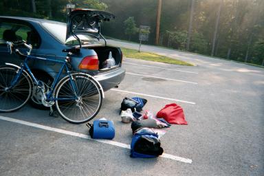
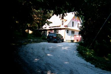
Loading my Jamis Aurora in Breaks Interstate Park, VA, Saturday, 9:15 a.m. 9/8/01. Below, the road to Haysi, VA, first morning. 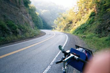
A PROLOGUE >>>>>
Twelve years ago I thought it was unique that I could travel most of the way from Athens, Ohio to Hendersonville, NC via US Highway 23. Unique because this highway (a four-lane) not only connects the South with the North, but it also connects Hendersonville, NC [where I lived 1976-79] with Columbus, Ohio [where I was born] with Delaware, Ohio [where I went to college]. WELL YOU DON'T SAY!
This trip is less momentous, you might say, as I am planning to take many different smaller country roads throughout eastern TN, western VA, and western NC.
AN INTRODUCTION ----- FRIDAY SEPT 7.
Not intentionally, I find myself looking for signs of good [or bad] fortune at the start of this trip. I don't do this for all journeys. But something makes me superstituous as I consider the prospect of sharing the road for a week with 2 ton cars and 18 wheelers. When I did this 12 years ago I was a college student - I was immortal for God's sake.
Maybe I shouldn't pay attention to the signs. For example, when I met friends in Missoula MT in 1998, the airline lost Sandy's baggage, leaving us to stalk a tiny airport terminal at the base of Montana'a Rocky Mountains. It delayed our drive to the trailhead by a day. But that was it, the rest of the trip was great, so who's to tell?
GOOD OMEN
On the Friday of departure I was still looking for a book to pack on the bike. Lo and behold, walking back from court, I walked past the semi-annual booksale at the downtown Cincinnati library. An hour later I came up with "Selections from James Joyce", Tolstoy's "Death of Ivan Ilych", "Don Quixote", Willa Cather's "My Antonia", and "Letters from the Earth", by Mark Twain. [All for $2.50] Plus I still had to finish "Into the Wild", given to me by Martin Terrell just weeks ago. Hmmmm, which do I carry on the bike........
BAD OMEN
Driving home after work on Liberty Street I pass a truck which is loaded to the top with the bodies of dead cattle. the bodies jiggle as the truck rides over bumps. I have never seen a truck loaded with dead cattle, especially in downtown Cincinnati. Now one can argue this doesn't mean anything. But you sure can't tell me it's a GOOD sign.
This might not be a good time to take "Into the Wild" with me. [About an adventurous young man who withers to death in the Alaskan wilderness]. [Given to me with a cryptic admonition inside. "Jon, PLEASE read this before your bike trip"] I decide to take "My Antonia". Which the NY Times says the Seattle Public Library is considering as a book the whole city will read together. It is about the author's move as a child from the VA Shenandoah Valley to the farm belt. COINCIDENCE: The fellow in "Into the Wild" who went into the Alaskan wilderness for adventure brought along few books, one being Tolstoy's "The Death of Ivan Ilynch".
THE DRIVE TO BREAKS, VA
The drive to Breaks, Va takes me down KY's Mountain Parkway. After passing the exits for the Red River Gorge it gets even prettier.
BREAKS INTERSTATE PARK, Breaks VA
I arrive about 9:30 p.m., and find a beautiful park in the dark. I follow a single lane park road as it winds among tall pines on both sides. Following the signs, my headlights find a very small hut along the road staffed by a woman who sits with a bug candle. She takes $7 from me for a tent site and tells me she'll give me a site nice and close to the bathhouse. "Sounds good!" I say, imagining the slamming sound of wooden bathroom doors opening and closing all night. First the sound of the spring extending, then the slam. But I just want to get the tent set up. Soon I see there are only a handful of campers in my area. There is a good 75 yard walk to the bathroom, and my worries are unfounded.
Setting up a tent in the dark is not that hard with a flashlite. But it is hard to tell where the ground is most level. I size up the ground like a golfer pondering his putt. This sends two fellows over from a neighboring campsite about 30 yards away with a gas lantern. "LOOKS LIKE YOU COULD USE SOME HELP!! They are about 50 yrs old and from Kingsport TN. One is very jovial. They are not drunk but in a good mood. Maybe they're retired. Maybe they're smoking pot. I don't know. They nail the lantern on the tree next to me and I tell them they're "Making it too easy' for me. They laugh at this and head back to their campers where wives and another couple are chatting around a picnic table.
SATURDAY >>> DAY ONE
Objective: Get permission from the park superintendent to park my car here for a week. The staff down at the Rhoderdendron Lodge tell me to look for Carl Mullins in his pickup, driving around the park. This seems futile. I decide to visit his staff quarters, where he kindly grants me permission. Carl Mullins is a kind fellow. Probably a retired military man. Reminds me of George C. Scott, who played General Patton. As I thank him and turn towards the car he roars "DAUGHTER!!?? ARE YOU READY??" A happy six year old bounces out of the house and takes his hand. They have errands to run I guess, it's Saturday morning.
(On the last day of the trip I notice a taxidermist down the road named Mullins and also read a historical marker outside Clintwood, Va, which says a Mr. Mullins was one of the first settlers in the area)
It is a cool Sept morning and the sun is burning off the fog. I pull the car into its weeklong parking space near the lodge and take out the bike. Screw on the front wheel and front fender. I load the bike and take a test ride. Now I know what it must be like to manuever a overladen airplane. Although most of the weight is on the rear axle, the front fork of bike jiggles and wobbles easily. It means I need to take it slow.
I start pedaling down the mountain to Haysi at 9:35 a.m. The road to Haysi is short (9.26 miles) but full of mountain grades. The morning is cool and the mist is burning off. I am giddy, and making numerous exclamations as I coast down hills and pump up the other side. No cars out yet.
I arrive in Haysi (9.26 miles) at 10:10 a.m. where I spot a bike loaded for touring leaning against a small grocery store. I stop and wait for the owner to come out. I am bent over checking my tires when "Hey ~!" Brenda is biking from Newport News to Kansas. I tell her she must know all kinds of Sinclairs in the Newport News area. She says she was in Newport only for a wedding and does not live there. She doesn't know any Virginia Sinclairs. A perfect shame.
She tells me the road ahead will be good to me, which turns out to be both true and false. I tell her the climb to Breaks, her destination, is tough but short. We head off in different directions after I approach the kids giving car washes in the parking lot and ask a kid to refill a waterbottle. It occurs to me this kid could spray me down in this little town and I wouldn't be able to do much about it. This 15 yr old boy/kid says, "MY BROTHER IS A BIKER! HE HAS A MOUNTAIN BIKE!" Really!", I say. He is very friendly and refills my bottle. He doesnt spray me. I head to Davenport.
The road largely follows a creek to Davenport (About 13 miles, arrive 11:22 a.m). It is sunny and hot. After Council, I climb a very wicked mountain that leaves me cursing road engineers. There are switchbacks going up, allowing some nice views of the valley behind me. There are moments where walking the bike may have been faster. It is much hotter now. I arrive in Honaker at 1:00 p.m., 37 miles FTD [For the Day]. The road to Rosedale is a 2 lane and the traffic pace and volume increases. The sun is harsh and I seek shade and peace from the fast traffic from 1:25-2:10 pm, 40 miles FTD. I am sitting so close to the road I don't find much peace. I start again and arrive in Rosedale at 2:34 p.m., 3 miles later. At this point it is hot and humid. My ambitious plans to take the "squiggly" Route 80 [read: switchbacks] to Abingdon are shelved as I wonder if I can even survive the easier path along Route 19 to Abingdon VA.
Route 19 is a rolling four lane Virginia Highway through farmland. There is no shade at all, unlike the 2 lane roads I pedaled this morning. However there is a full shoulder and I feel safer on this road than I have all day. At 2:50 p.m., 46 miles FTD, the sun is sapping all energy. I cannot push up the smallest inclines in the sun. I turn off onto a small county road and nap again in the shade for an hour. At 4:00 pm it is still hot but I know it will be difficult to reach Holston Lake, TN (40 more miles) by dark if I don't move.
ABINGDON VA
Abingdon VA is one tony town. (6:00 p.m., 74 miles FTD) Abingdon looks like a small Georgetown, with red brick sidewalks, restored old buildings in nice white paint, and arm-in-arm couples sauntering up the sidewalk to evening socials. They are no help in finding the closest grocery store, however. "We're not from around here" one couple says. I find the local Kroger's and quickly collect about 2,000 calories (2 boxes of the Gooey-sauce Kraft Mac and cheese) and Gatorade for dinner. I estimate I have about 12 more miles to go, but this turns out to be half the miles to my expected campsite.
The road to Holston Lake TN is flat. Dusk starts to set in and it gets cooler. I have much more energy now but only about an hour of light left. Near dusk I see two signs for private camps and turn down a side road off of Route 75. The first camp is out of business. I can't find the other one. I find Washington Park, a former facility of the Tenn Valley Authority, now a park of Washington County. The camp store is closed. There is a guy at the entrance booth. Campsites are $15.30 and there are SHOWERS!. I feign displeasure at this price and ask him in a snooty way how much RV campers have to pay. If this guy only knew how much more I would pay for this place. mmmm...**SHOWERS** Arrival 7:20 p.m., 85.33 miles FTD [For the Day].
I put up the tent in a grove of pine trees as the sun sets across the lake.[photo below] I eat two boxes of Mac and cheese with 1,000 calories each. I feel sick. I am totally wiped out and in a bad mood though I am very lucky to have this nice site along the Holston Lake. I walk through the trailer camp to the baths for a shower. While getting dressed after the shower, 3 teenage boys walk in, single file, brushing their teeth. Without saying a word, they circle around one sink and continue brushing. I comb my hair in a sink next to them, while they continue brushing, looking about now and then but still not saying anything. I leave without hearing them say a word. I hang the food from a tree. Bedtime is 10:30 pm. I have no plans to read my book tonite [My Antonia]
DAY 2 - SUNDAY.
I get up before the sun, at about 6:30 am. Four or five packets of oatmeal for breakfast. Three bananas. Cleaning the pots and packing the panniers means I don't hit the road until 8:14 a.m. The two-lane Route 75 is quiet this Sunday morning and it is sunny again. After an hour I pass into TN and reach the destination planned for last nite. Jacob's Creek State Campground [N. of Rt 421] is 11 miles further and halfway up Holston Mountain.
I reach the top of Holston Mtn at 9:53 am, 15.28 miles. It is a steep mountain but with only a handful of cars passing in the cool morning, the climb is quiet and enjoyable. Nice forests on both sides of the road. The Appalachian Trail crosses the road at the peak. I descend the other side, which is steep. It is still cool. Flying down the hill, I spot what looks like a dead dog in the middle of my lane. He is a beautiful brown dog about the size of a Labrador and I see he appears to be lying just yards from his owner's driveway. Apparently the Sunday morning sun makes the black asphalt nice and warm, because my clicking hubs wake him when I am only a few seconds away, going 35 mph. He jumps straight up and watches me pass from his driveway.
The ride down the mountain to Shady Valley (10:00 a.m., 17 miles FTD) seems too quick. It doesn't feel like I descended as far as I climbed the other side. Of course I feel this way about most mountains, but it turns out I am right this time. Shady Valley is a plateau of farm pastures, and higher than Holston Lake. There is one store in town, a convenience store at the corner of Route 421 and 91. He tells me there is no way to get out of Shady Valley without climbing hills. He says I must climb 'Arm' mountain as I head south on Route 91. I say "Arm? A-r-m?" He says
"Arm. I-r-o-n"
The top of Iron Mountain is not a hard climb from Shady Valley, four miles and 50 minutes riding, but it is a long steep ride down. There is little traffic all morning. On the way down, about 35 mph most of the way, I enter the Cherokee Nat. Forest and the 2 lane road becomes totally shaded by the forest on both sides. It is cool and the smells from the forest remind me of the Hendersonville years. The ride down takes 12 minutes but I cover five miles. The road to Elizabethon TN seems to be slightly downhill the whole way. I think this means I have a tail wind of some amount. I reach Elizabethton at 11:50, at 40.87 miles FTD. I average about 18 mph during that last 15 miles.
Elizabethton TN is not small and pretty like Abingdon. It is spread out and flat and sunny and hot. I choose ham sandwiches and gatorade at the grocery store for lunch [$5.42] and find a shady tree along noisy Route 321 to eat and nap from 12:45-1:45. Total miles 44.05. The ride after lunch is hot and hard. I pass Roan Mountain at 3:12 pm with 59 miles FTD. I find my topo map does not show a tough mountain on the TN/NC border, though I should have expected it. Many state borders are at the top of mountains.
The sky starts to cloud and mist in the late afternoon, as I pass through Newland NC, south on 194. My glasses need windshield wipers. I stop in a grocery store and shop for dinner (tuna and pasta). I see lots of Christmas tree farms on Route 194 to Linville Falls NC. The last few miles to Linville Falls along Route 221 is dangerous with cars in a hurry and my first experience with rednecks. TN and VA were void of rednecks. NC is a pretty state but full of young assholes.
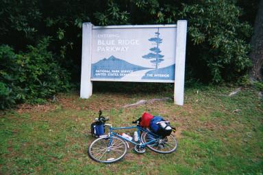
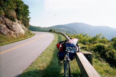
The NC Blue Ride Parkway is the prettiest sight of the last 2 days. In front of me is a beautiful stone bridge over Route 221, built by Italian and Spanish immigrant masons in the 1930's. The parkway seems no wider than a driveway and covered with a canopy of trees and forest. Everything is dark green except the black, narrow parkway that curves away in each direction. Quiet and no cars. I need to head north about 3 miles to the Linville Falls Campground.(Mile marker 316.4) 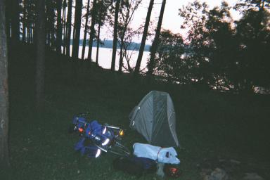
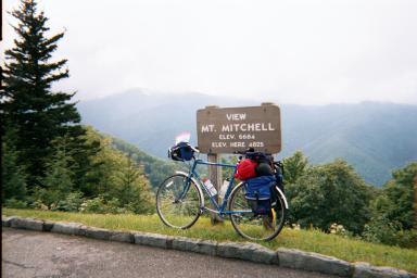
Above, the first camp, along Holston Lake, TN. Below, the next morning, climbing Holston Mtn on Route 421. On the way to to Shady Valley, TN. Bottom, the Parkway sign in Linville Falls NC. 
 I ride up Route 221 a few hundred yards to a empty motel to call Sara and give her a report then head for camp. I arrive at the campsite about 7:15 pm and there is little time to choose a site, set up camp, and cook. Tent sites are $12.00, without showers or hot water. BEFORE the trip, I celebrated camps with limited facilities. "Primitive" sites.
It's a pretty nice camp but most of the people are in campers. Most look to be retirees in campers, maybe because it is Sunday nite after Labor Day and the younger families are back in school.
I find a nice site under pine trees because it is sprinkling and rain is expected tonite. I cook my pasta [plain - no mayo,ughh] and mix in tuna in the dark. Seeing a shadow slink by under the picnic table, the beam of my flashlight finds a bold skunk passing through. Total miles 87.13. It rains overnite without serious problems. There is moisture on the outside of the sleeping bag at the bottom where it touches the roof. This happens all week, with heavy dew in the a.m. [I have a Sierra Designs Light Year]
MONDAY MONDAY MONDAY
I leave camp at 9:00am and head north to check out the Linville Falls. It is about a 1.25 miles away. Because I am anxious to make a good start for the day I rush my visit to the Falls, which are among wet, dark green paths with encroaching Rhododendrons on either side. I walk down and take a self-portrait. The Falls are not much to see. On my walk back, a man about 50 yrs old is pushing someone down the gravel path in a wheelchair. He makes a cheery comment about his efforts, but the gravel is wet and the path is steep ahead. He is strong. 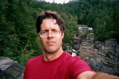
Heading South again I pass the camp at 9:48 a.m. and 2.50 miles For the Day. There are very few cars on the Parkway, which is still wet and cool. Cars travel slow and move all the way over. Asheville is 70 miles away. Every mile of the Parkway is maintained like someone's front yard. The grass is trimmed everywhere. The woods on either side are thick and smell like N.C. There are overlooks every few miles.
At 18.07 miles FTD, I stop by the Mineral Museum and eat some granola bars from 11:30 - 12:00. A German tourist chats me up about his altimeter watch. "Vee are at 1240 meters, which is about ...hmmm.. in feet..." He looks skyward to calculate. "Ahhhh...hmmm" I tell him "It's 3600 feet", because I happened to know this. He continues to look up, doing the math. He loves the watch. "Let's see ..I vood say ..." More calculating....then...."dat izz about 3600 feet!!" He is very satisfied. "Really!!" I say.
At 2:40 p.m. I reach MM 348, which is 36 miles FTD. The climbs are long and hard but the grades are never ridiculous like in western VA. I believe the BRP was built with few grades over 7%.
The sun disappears altogether after 1 p.m. which is partly due to the weather and partly altitude [max. 5,676 feet] During the afternoon fog and clouds obstruct views and the Parkway. From 3:02-3:50 pm I rest at the lonely and quiet Mt. Mitchell Overlook at mile marker 350, which is 38.05 miles FTD. My average speed is 9.5 mph, which is about the slowest of the trip. I have been mostly climbing all day. The foggy quiet is broken only when a large white SUV driven by a retired couple from Florence S.C. pulls in and we take each other's photo's. 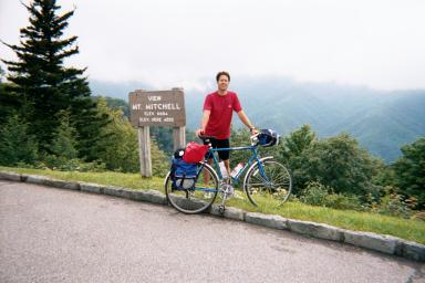
The couple from S.C. are in their 50's and they tell me about their troubles. They have a home in Florence and a home in the Adirondacks of N.Y. They love their home in the Adirondacks but they only like to spend time there during the summer. So they have come to western NC this week to find a 3rd home in the mountains of NC. This third home must have a natural lake on the property and must have this and must have that, she says. They are having the "...most terrible luck finding just the right place!!". We take pictures for each other and I wish them luck on their home search. A much different couple in their 40's arrives in black leather on a Harley. I take a picture for them.
I have decided to try to make Asheville if I can because splitting the ride into 2 days would put too much time in my hands. With the cold, wet weather, I don't feel like setting up camp in the early afternoon. A motel room in Asheville dances in my head like sugar plums.
Around mile marker 357-359, I note what seems to be the highest point, and the road grade begins to slightly head downward. Later I find the highest point is mile mark 358.5, at 5,676 feet. The nine mile ride between the Mt. Mitchell Overlook and mile marker 359 takes me 1 hr and 20 minutes.[7 mph] I have 47.55 miles FTD. It is 5:10 p.m. and still foggy and misty.
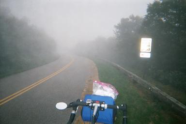
Somewhere near Craggy Gardens Visitor Center, marker 364.4. The road sign says there is a Scenic Overlook ahead. Very foggy. Visibility is about 40 yards. Below, Craven Gap Overlook, marker 377.4 mile mark, 3,132 feet. 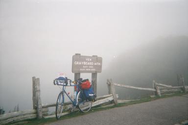
CRAGGY GARDENS >>> HALLELUJAH
It is still dim and foggy when I roll into the Craggy Gardens Visitor Center, mile mark 365, which is closed and deserted. It is like a ghost town. Very quiet. Mist droplets drift past like snow flurries. That's the only action. No cars pass. I fill up my water bottles at a fountain. It seems be getting dark, though I can't even see the sky or horizon because of the low ceiling. It is 6 pm and I have 53.36 miles FTD.
This Visitor Center means one thing to south-bound cyclists. DOWNHILL TO ASHEVILLE. YEEE -HAW. Leaving Craggy Gardens I maintain 30 mph for miles at a time. In 27 minutes I cover 12 miles. [25.4 mph ave.]At the Tanbark Ridge Overlook I am down to 2,782 feet [or 3,175?]. It is 6:33 pm and I have covered 13 miles in 27 minutes [23 mph ave.] The descent continues mile after mile. I descend through the mist. It is sunny again and seems to be two hours earlier than 6:30 pm. Looking left, Asheville is spread out in the valley below. At 6:52 pm. I reach the valley floor, where I take the Route 70 exit (Marker 382.6 and 2,040 feet) and head for Asheville. I have gone 72 miles, covering 18 miles in the last 50 minutes, descending 3,500 feet. [21 mph ave.] This includes stopping at 3 roadside lookout points on the way down to read the historical signs.
Route 70 becomes Tunnel Road as you head west to town. It is home to a string of old motorist motels, each one u-shaped with a empty pool in the middle. I take the first one I see, which for the era, was suitably named MOTEL THUNDERBIRD and spend $30 for a room. I have 73.70 miles for the day, a 10.9 mph average, and 6 hours and 46 minutes in the saddle. Dinner from Ingles Grocery Store, $11.72. Deli sandwich, apple fritters, bananas, yogurt. SHOWER & TV!!
TUESDAY SEPT 11
I leave MOTEL THUNDERBIRD for Asheville at 8:40 am. Downtown is about a 1/2 hour away. It is sunny and cool, I make wrong turn and head north through the Asheville Tunnel on Route 70, then turn south and head through downtown. I write 4 postcards while sitting on my bike in Pack Square, leaning against a post box. It is about and 9:10 am. I head to Hendersonville on Route 25 which is an assortment of retail activity until Fletcher.
I roll past a coin laundry just north of Hendersonville and decide to do my laundry. It is about 11:30 am and about 5 people are sitting around a TV on the wall, which shows a southern Manhattan skyline with a trailing cloud of dark smoke. No one is talking. Somehow a TV reporter has rounded up chiefs from the N.Y. fire department and Port Authority to answer questions. They only give information about how many people typically work in the trade towers. They look lost. I ask aloud why they are not busy directing the emergency response. No one says anything.
I find downtown Hendersonville around noon. It is sunny and retired folks are strolling the street. One couple checks to make sure I know about the latest news. I visit the Western Auto store where I won a bike in 1976-77. They take my picture. I get a corn beef sandwich from the old Coca Cola store and write postcards from a park bench. A cop gives me directions to Laurel Park. For an hour I sit in a gravel road and change a spoke near Lake Avenue, about 50 yards from what used to be Laurel Park Lake. There is no longer any water, though the outline of the former lake remains. It is a marshland now, with high grass and bushes. A sign says it is the future site of condos. 
Lake Road, Hendersonville, NC 9/11/01, 2:00 p.m.
Photo taken from the spot where I attempted to crush a broken bottle with my shoe in 1977, sending an inch of glass into my foot. Between the road and the building was once Laurel Park Lake. In the middle was a 2 story wooden diving platform. Also the place where canine Blackie [R.I.P.] was rescued from a hole in the ice by the fire dept in 1976+/- 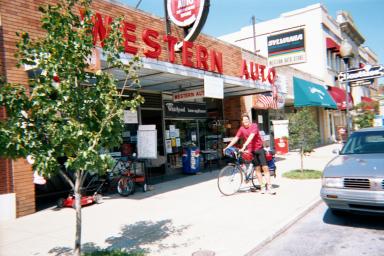
Western Auto store on Main Street in Hendersonville, N.C.
No longer giving away bikes. Fixing the spoke puts me behind schedule. I am still in Hendersonville and it is 3:30. I drive past the old house and consider visiting, but don't think today is the right time to be knocking on stranger's doors. Before dark I need to get to Mt. Pisgah, on the Blue Ridge Parkway, which is at 4,925 feet. I stop for groceries as I jump on Route 64 West towards Brevard. It is sunny and comfortable, but I have "a long way to go and no time to get there, and I'm doing what they said can't be done." This is a line from 'Smokey and the Bandit' which I think I saw in Hendersonville in 1978-79. Burt and his black Trans Am. Sally Fields. Jackie Gleason, busting out of his sheriff uniform.
Route 64 west has many signs which say SHARE THE ROAD, with a bicycle glyph. It seems the state is promoting the route for bikes. This is pretty funny because there was rush hour traffic on Route 64 this afternoon, flying down this two land road at a LEGAL limit of 55 mph. Which means cars were going 60 mph+. As I ride I imagine what I would say in a letter to the Governor. 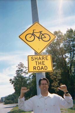
This sign is actually in Cincinnati. Below is the Hendersonville NC family home [1975-79]. New siding was being installed. The house is up the hill from the lake.
This really is rush hour traffic. I wonder if everyone is heading home quickly to be with family because of the terrorist strike this morning. I reach the interesection of Route 276 and 64 at 5:10 pm with 48.17 miles FTD.
Ahead of me, Route 276 disappears into the Pisgah Forest, taking me past Sliding Rock and up 9% grades to the Blue Ridge Parkway. The car traffic disappears, turning away for Brevard and Asheville. The road ahead is one of the more difficult of the week. The Parkway offers long climbs grades of 7% or so, but never delivers torture inclines like the ones I see this evening. The only good thing about climbing in the mountain is that I can only see one curve ahead. If I could see though the trees and see the distance and climb ahead, ...well.., it would certainly hurt morale. Better to be ignorant and just pedal.
The climb to the Parkway is a slow, 14 mile climb. The sun is setting and is totally shaded by the Pisgah Forest canopy. It smells like NC woods. These 16 miles require 2 and 1/2 hours of pedaling [5:10-7:30] at a walking pace or slightly better. [6.78 mph ave.] Only 2 or 3 cars pass me every 1/2 hour. When I reach the top there is maybe a half hour of light left and I still need to pedal 3 more miles and climb 400 more feet to the Mt. Pisgah Camp, at 4,925 feet, mile marker 409. Before getting on the Parkway I speak with a guy who just climbed up the other side on a brand new yellow Cannondale. He says the new bike is a rehab present. This requires further questioning but I have a half hour of light left.
From a distance of about a mile, the curves of the Parkway take me out wide around Mt Pisgah and I can see an oasis of yellow lights ahead. Mt. Pisgah has a state run lodge across the Parkway from the camp site. One spot along the mountain is yellow with lights. It looks like a cartoon in one of the Tintin Adventure books, where Tintin and the Captain see the night's resting place. I arrive with a bit of gray light left, it is 8:15 pm and I have 68.05 miles FTD. There are many postings that warn of bears in the camp. I find a spot, eat roast beef sandwiches in the dark, and hang my food bag from a tree about 30 yards away. During the night, something pushes my purple backpack off the picnic table.
WEDNESDAY >>>>>>> Sept 12
I dont leave Mt. Pisgah until 9:45, watching TV news in the lobby of the park lodge across the parkway. It is sunny and cool and the breakfast dining room looks more than half full of retired folks and late season vacationers. I ride back down the parkway to Route 276 and head down the other side. It is very steep and I am holding on for dear life. Ironically, this is also the friendliest segment of my trip as many of the cars heading up the hill seek a wave from me. When not rounding a curve, I pry a hand loose, wink a few fingers, or nod like a good southern fellow.
I reach Cruso at 10:26 am with 12.43 miles. I reach the flatlands, where I cross Route 215 at 10:50 am, with 19.50 miles. Tomatos seem to be one of the biggest crops here. I pass a group of Hispanic farm hands in a barn on the way to Waynesville. I ride into Waynesville at 11:30. Since leaving camp at 9:45 am, I have covered 26 miles. I get a reuben and use a sidewalk bench until 12:30 pm. Waynesville has a Main Street that is part tourist-quaint and small-town North Carolina. It is not as refined as Hendersonville, which is not as pristeen as Abingdon, VA. There is one very nice newstand with papers from around the world with the story of yesterday's attacks. I leave Waynesville at 12:30 for Hot Springs.
It is plenty hot and the shaded forests are behind me. The road to Hot Springs, Route 209, is a two-land through open pastures and farmland. Once I am north of I-40, the traffic disappears and it's just me and the cows. I try to capture the sight of 60 dark brown cows staring at me as I roll by. Not many bikes come through here. I reach in the handlebar bag for my camera and they all turn tail together.
The first 10-12 miles of Route 209 are sometimes straight ahead, where I can see the next mile in front of me. Somehow this disguises the road grade, as it seems very hard to pedal but the road does not look steep. It is sunny and hot. I reach 40 mph down Ferguson Hill, which is steep pasture land for cows, then turn right and head for the woods again. There is one steep climb up Hebo Mtn at 3:00 pm and I have 46 miles FTD.
I am riding down the mountain when I pass Luck at 3:10 pm with 50.9 miles FTD. Six minutes later at 3:16 I have 52.33 miles. In the last 16 minutes I have covered six miles. From here to Hot Springs the road curves through woods and pastures and there is almost no traffic. This route is a ghostown of former roadside business with fading advertising on old wooden signs. B & B Grocery is an old wooden building on the edge of Route 209 with a faded Pepsi sign from the 1930 or 40's. I pass a porch of old men, where I hear one say 'Big hill head ah yuh'.
At 4:20 pm I reach the poorly maintained Rocky Bluff Campground, four miles south of Hot Springs. The only camper is the camp host, someone paid by the state to monitor the campground. The water supply has been condemned, which lowers the campsite cost to $4.00. There is an old cemetary in the camp. This would be the first truly private and quiet camp of my trip. But after riding around I find it TOO quiet and the cemetery TOO close. I decide to check out the private camp in Hot Springs (Hot Springs Resort 828-622-7676)
The rest of Route 209 to Hot Springs is all downhill. The Springs is truly at the bottom of all hills, because the next morning I climb straight up for 3 miles on Route 70 east. I average 6.1 mph.
I ride into Hot Springs at 4:45 pm with 68.43 miles for the day. There is not a stoplight in town. There is a collection of 6-7 businesses at the intersection of Route 209 and Route 70. Many of them, even bars and grocery stores, have already closed at 5:00pm. It feels like the end of the tourist season. I visit the Hot Springs Resort campstore and get a tentsite with showers for $10.
I decide to spend $12 for an hour-long soak in the Hot Springs, which now amount to 5 outdoor modern hot tubs. They are located on the same site that hosted many different hotels since the Springs became popular in the 19th century. One of the grandest Hot Spring hotels was burned down by a boiler explosion. The current hot tubs have only been around since the mid-1990s. During my hour in the tub I can't see the novelty, thanks to the modern tubs and because the mineral water doesn't feel any different. Call me a cynic. I read a TN newspaper.
I can't wait to get in the camp showers and use soap to get off the sunblock. But first dinner. I explore the only open restaurant in town, but it smells like years and years of toasted white bread with margerine. A woman looks up at me from a table and mumbles "...you can sit anywhere". That much is clear. There is only one motorcycle touring couple there. They look at me and their eyes say "GET OUT WHILE YOU CAN". I think that is a good idea.
I decide to visit the campstore and get a box of mac and cheese and a can of Dinty Moore stew. This is the best dinner of the trip. Combine the two. I eat in the dark and hear the mighty French Broad River across the camp drive. There are very few campers, none near my site.
Above, the view from where I saw the lights of the Mt. Pisgah State lodge last night. Below is the campsite picnic table with stuff thrown about. Lots of white plastic bags for waterproofing. In the back, my Sierra Designs Light Year, about 3.5 pounds. Nice tent though not self-supporting [stakes req'd. 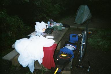
THURSDAY >>>>>>
At 8:30 the next morning I am sipping coffee outside the Hot Springs Campground store. A man about 55 walks up and look familiar. I recognize him from the literature about the Springs. He owns the hot tub operation. I was wondering last nite so I ask "Does the mineral water come up from the basins in the old concrete bathing house?" I ask him. He tells me about the health benefits of mineral water. I try the question again but with no luck. I hit the road. I bet he pays a water bill, which would answer my question.
The road east, Route 70, is straight up (8% grade) for 3 miles. It takes me a 1/2 hour and I move at 6.1 mph. At the top there is a modern walk-bridge that carries the Appalachian Trail across the highway. I roll down the other side, heading north for Johnson City TN. It is cool, and the morning fog is burning off.
The next few hours are the most peaceful of the week, as winding river roads take me down Route 208 and Route 212. There are no shoulders on these two lanes but there is no traffic this morning either. There are pinetree forests on both sides and the river is just bigger than a creek. It is 9:43 and I have 8.6 miles. There are maybe 1-3 cars passing each 1/2 hour. Route 212 is in NC but just south of Tennessee. It is lined with tobacco farms and the Cutshall family. These roads are the last peaceful rides of the day, as I reach the major highway Route 23 about 12:30 pm with 40 miles. This is Erwin, TN, which is kept hopping by Route 23 business. I eat and then surf the internet at the public library until 2:00 pm. If I only knew I had to cover 60 miles before dark.
Johnson City and Kingsport run together. Both have deserted old main streets but big malls. At one point I am pedaling down a major four lane road (Route 36) in Kingsport, lined with full scale malls. I decide to take Route 36 north to Kingsport, along Interstate 181. This is the most dangerous and busy 2-lane road of the week. It is a former country road that has become a commuter road between Johnson City and Kingsport. Pure hell.
I continue nonstop through Kingsport. The traffic is so heavy and the landscape so drab that I decide to past up Warriors Path State Park, south of Kingsport. The battle is now joined. I am now committed to Natural Tunnel State Park in Clinch Va. This will require over 100 miles for the day. In Kingsport I hustle up Route 23 which brings me into VA without fanfare. I run into Food City, Weber City and spend $8.04.
I have about 15 miles to cover on Route 23 to get to Clinch VA. It is about 6:00 pm and the sun is setting in front of me. Traffic is light on this four-lane. I do the hustle, spinning the pedals really hard, trying to beat the sun. I am very lucky to find that most of Route 23 seems to be going downhill today. I find the campsite at 7:15 pm with 102.60 miles. The park is about 2 miles from Route 23 and up the steepest hill of the week. [Did I already say that?] Rain clouds start to roll in as I chat up the camp host about using one of the hookup spots. He says I'll have to pay the hookup rate, which he agrees is a crock. "I don't make the rules" he says. I put up the tent in a forested tent-only spot just before it starts to rain. The stove is hard to ignite, but it does. Sara's waterproof matches come in handy. I have my mac and cheese and dinty moore stew combo again. It is raining.
FRIDAY >>> DAY 7
Today is a short ride to Pound VA, 51 miles. In the woods, the trees are still dripping and I can't see the morning sky to see what the day looks like. Walking out to take a shower, it looks like an early cloudy day in October. I slack around and use up all the hot water in camp, hoping the sun will come out. I eat a whole box of raspberry Nutri-Grain bars with a cup of Dannon Yogurt. FYI - Yogurt does not have to be refridgerated overnite if the nights are cool. I did this more than once.
I don't leave until 10:25 a.m., after being handed a Baptist pamphlet from a fellow camper. He looked like the thin guy in Psycho who lived with his mother. He was camping with his wife, who looked like a short thick Amish farmer. He asks me a few questions about my trip, but is hardly interested in the answer. Then he goes for it. "Well, maybe we'll meet up again someday, let me give you one of these." Gotcha. It cites many Bible passages, each of which say I will rot in hell if I don't sign up with the Baptists.
There is a lot of traffic on Rt 23 and it seems more threatening than last nite. I reach Big Stone Gap at 12:05 with 20 miles. It is still gray, dark, and the clouds are low. It is chilly. I ask the CVS clerk in Big Stone Gap if there are any fast food places in Norton, which is about 15 miles down the road. She says she has lived in Big Stone Gap her whole like and has never been to Norton. Big Stone Gap is small. Really small. It is a sad old mining town. [coal and stone, I think}
The old Route 23 to Norton is called the Business Route. It winds past coal mines that are in full operation. At 2:00 pm I eat at Burger King and Taco Bell in Norton with 36 miles FTD. I sit and wait until 3:30 in Taco Bell because it is misty and the clouds are no higher than the hillsides. I only need to go 15 more miles to Pound. I decide to leave while there is still a light mist. The traffic is heavy on Route 23, a four-lane. Rolling up to a red light, a truck carrying new cars passes me by an arm's length. Instinctively, I flip him off. I don't think he notices in the rain. I pull off the highway for a few minutes and watch a stray dog dodge traffic on a side road.
It is finally sunny in the afternoon when I reach Pound at 5:00 with 51 miles. It is clear and sunny again. I find out Phillips Creek Campground (Jefferson Nat. Forest) is 6 miles west of town on Route 671. I find the park at 6:00 and there is no one there. There is a small pond/lake and a sign says GROUP camping is permitted by reservation. My bike and myself is a group and I am not in the mood to ride back to Pound. There is not one person or car in the park. 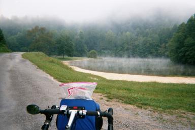
Phillips Creek, Jefferson Nat. Forest, Pound VA.
The morning after my lonely night of 'group camping', which included me, my panniers, my bike, .... I get off the bike and start pushing it down to path towards a number of picnic pavillions in the woods. After 10 minutes I am far from the last parking area and deep into the woods, where there is another pavillion and an open field of grass and some pine trees. It is very quiet and the sun is setting. I set up the tent behind a tall pine tree and have dinner ($7.71) Another box of Nutri-Grain bars for tomorrow. Two apples. I have 59.03 miles total.
After dark I get in the tent and for the first time during the trip I read "My Antonia". When it is completely dark the frogs and crickets start making noise. After a minute there is only the faint car of a car passing on the road. An owl starts to coo but it doesn't sound right. It's a higher pitch. I wonder if someone is making owl sounds. It is Friday night and I wonder if local teenagers will be coming out in the middle of the night.
After going to sleep I get out at 2:00 am to use the bathroom. It is a clear night with heavy dew in the air. I check out the stars and then get back in. The owl has stopped. I am camped on the edge of the woods and now hear dew dripping in the trees. It sounds like light rain.
When it starts to get light at 6:30 a.m. I see that I have survived all the goblins and now wish it was dark again so I can sleep. The dew is dripping and there is lots of fog. At one moment I think I hear a car door shut, but it is really hard to tell. Then someone sneezes. I jump straight out of the tent and begin planning my excuse to the park ranger. I look out and see a man in green walking in my direction. He stops when he sees me and my tent and then starts again, waving. He has a gun slung over his shoulder and he continues walking in the fog, over a bridge 50 yards away and into the woods. About 15 minutes later I hear a shotgun. Then more shots while I pack up camp. Maybe hunting season starts today.
The road back to Pound, Route 671, is a two-land curvy county road that I don't want to ride in the fog. I eat NutriGrain bars one after another until I have a stomach ache. There is nothing else to do waiting for the fog to lift. I leave at 9:10 am and reach Pound again at 9:40 with 6.82 miles. I have a cup of coffee in the Coastal gas station, the only place open in town. The sun has burned through when I leave Pound at 10:15 a.m. The road to Haysi VA is full of mountains and hills but I only have 37 more miles to go, so it's hard to complain. I reach Clintwood at 11:05 with 16 miles, an old coal mining town. I each Clinco at 12:06 with 28 miles. The last miles to Haysi are very fast, getting there at 12:38 with 35 miles.
Leaving Haysi after lunch I meet Cary Segall going in the opposite direction, pedaling coast to coast on the Transcontinental Bicycle Route. He has an great set of maps, made by AdventureCycling.org. He is short and wiry, about 45 years old. He has taken leave from a Madison WI newspaper to travel coast to coast. His son was with him from the West coast until Chicago, peeling off to head back to school. Cary has on a red cotton shirt that is BLEACHED on the shoulders from the SUN. Awesome. I have NOTHING like this. I am humbled. We take pictures of each other.
At 2:45 pm I am back at the car, with 44 miles for the day. There is no brass band to greet me. It is sunny and Breaks Interstate Park is still pretty. I take my time unpacking the bike and loading up. Then head for Cincinnati.
THE END
roll credits..... 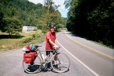
Cary Segall of Madison WI, biking coast to coast.
Here between Breaks and Haysi, VA on 9/15/01. |